Disaster Management
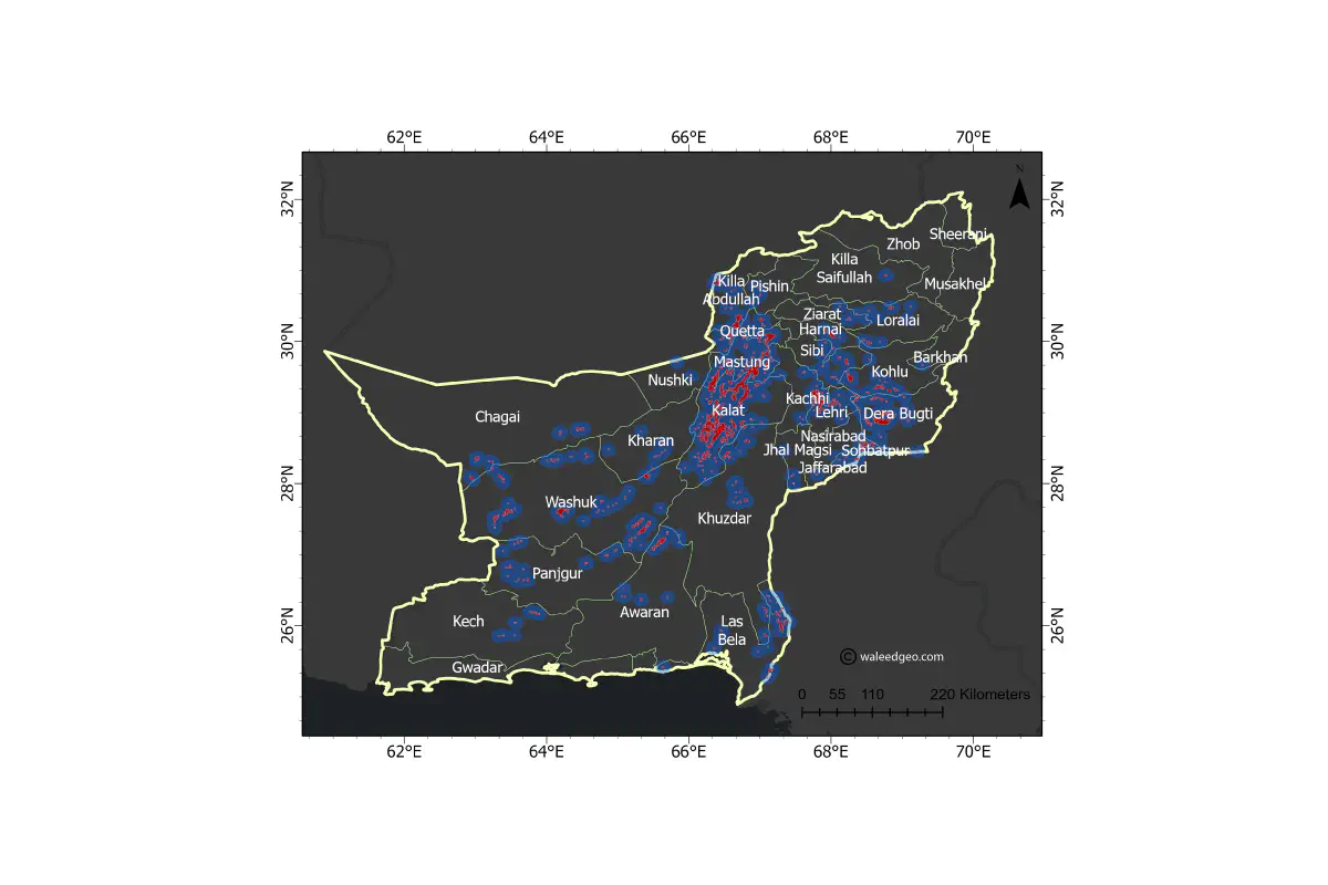 A preliminary flood hazard map of Pakistan FLood 2022 using Sentinel-1 SAR data
Pakistan is one of the world’s most flood-prone countries, experiencing devastating floods in recent years. Despite efforts to mitigate the impacts of floods, there remains a significant research gap in flood hazard assessment. This research gap includes the lack of detailed and accurate flood hazard maps, limited understanding of the factors that contribute to flood susceptibility, and the need for more research on the impacts of floods on vulnerable populations.
As a Pakistani PhD researcher in remote sensing, flood hazard studies inspire me for two key reasons. Firstly, due to Pakistan being among the world’s most flood-prone countries, studying flood hazards can help refine management strategies and reduce the risk of future floods. Secondly, remote sensing technology has transformed the field of flood hazard assessment, susceptibility, risk assessment, and damage assessment. This technology offers innovative and efficient methods to comprehend and mitigate flood risks. As a remote sensing researcher, I am eager to create a positive impact on the lives of people in Pakistan and beyond.
If you’re interested in learning more about my research on floods, take a look at my publications or feel free to contact me directly. You can also check out some of my best visualizations on disaster/hazards in the visualization section. I welcome collaboration opportunities and look forward to sharing my research findings with you.
Note: I am actively working in this domain and will update this section as I publish more work.
Some of below works are currently under review…
On the Emergence of Cloud-based Platforms for Disaster Risk Assessment: A Scientometric review of Google Earth Engine Applications (Review Paper, submitted in International Journal of Disaster Risk Reduction)
Compartive analysis of flood susceptibility mapping using various open-source machine learning models (Research Paper, undergoing)
National Scale Flood Susceptibility Mapping using state-of-the-art machine learning models (Research Paper, undergoing)
Mirza Waleed
PhD Researcher | Google Developer Expert
I am a Ph.D. Fellow at Hong Kong Baptist University, specializing in geospatial data analytics techniques, cloud computing, and artificial intelligence for disaster risk management, especially for flood hazards. I am also a Google Developer Expert in Earth Engine category. My goal is to use geospatial technologies to create sustainable and resilient communities. Let’s connect and collaborate to make a positive impact.