Urbanization
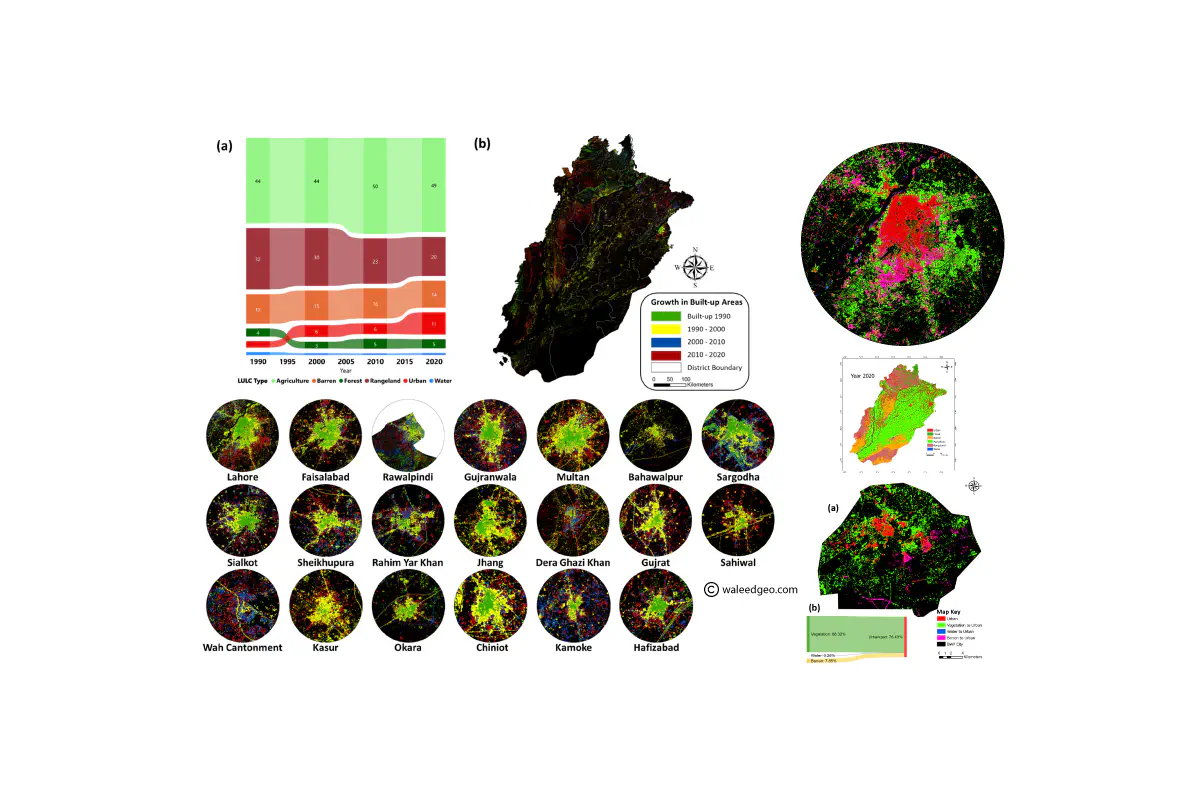 LULC Maps taken from my Paper on Punjab and Bahawalpur
In today’s rapidly changing world, the impact of land use change on the environment and society cannot be ignored. That’s why land use change assessment is so crucial. By analyzing how human activities are altering the Earth’s surface and ecosystems, we can identify areas that are at risk and promote sustainable land use management strategies. This is the focus of my research domain.
Using multi-spatial and temporal remote sensing data, I analyze land use change at local, regional, and global scales. My expertise in analyzing historical land use patterns and predicting future changes has been developed through extensive research and publication.
My ultimate goal is to provide valuable insights to policymakers, planners, and stakeholders. By informing decisions related to land use planning, conservation, and management, we can create a more sustainable future.
If you’re interested in learning more about my research on land use change, take a look at my publications or feel free to contact me directly. You can also check out some of my best visualizations on land use change in the visualization section. I welcome collaboration opportunities and look forward to sharing my research findings with you.
Some of my best work in this domain:
Mirza Waleed
PhD Candidate | Google Developer Expert
Mirza Waleed | PhD Candidate | Google Developer Expert in Earth Engine