
Skip to content

I am

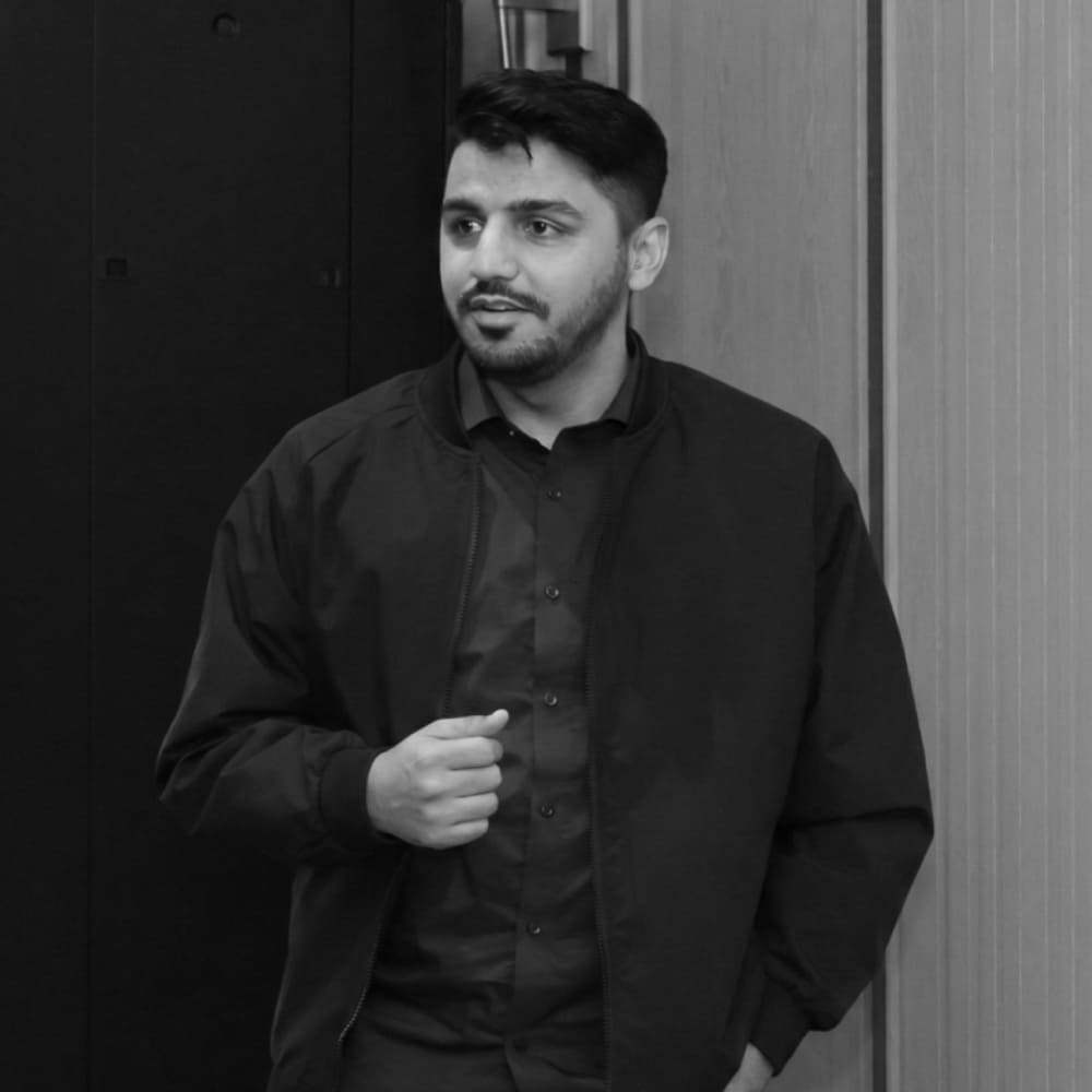
Mirza Waleed

I build GeoAI systems for
Flood intelligence, climate adaptation, geospatial machine learning, and earth observation operations.

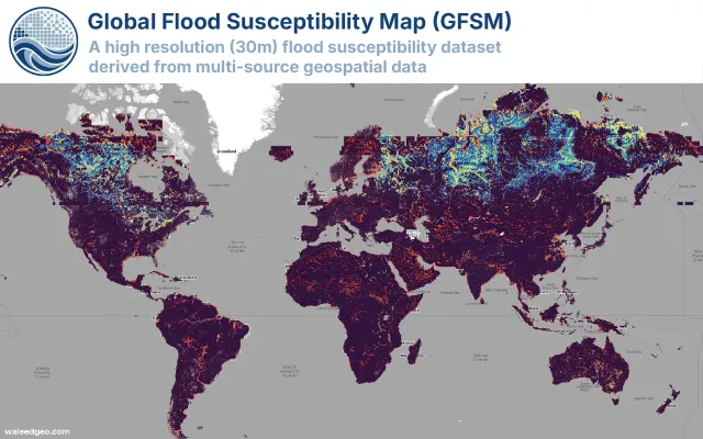
Ph.D. Candidate in Geography (Remote Sensing & GeoAI) at Hong Kong Baptist University and Google Developer Expert for Earth Engine. I build scalable, decision-ready Earth observation systems for flood risk, urban environments, and climate resilience — from GFSM v1, a 30 m global flood susceptibility dataset, to near-real-time flood and wildfire mapping frameworks.

01.

About Me

I'm Mirza Waleed, a Ph.D. Candidate in Geography (Remote Sensing & GeoAI) at Hong Kong Baptist University — including a visiting appointment at KAUST on the Shaheen III supercomputer. My doctoral research integrates multi-sensor satellite data, hydrologic predictors, explainable AI, and cloud/HPC computing into operational flood-intelligence pipelines.

As a Google Developer Expert for Earth Engine (one of roughly 50 worldwide), I combine cloud-native geospatial computing with ensemble machine learning and deep learning, scaling workflows from exploratory notebooks to production-grade research pipelines for flood risk, urban climate, and land-cover monitoring.

This work spans 18 peer-reviewed journal articles, including two Web of Science Hot Papers, and two flagship systems I lead: GFSM v1, a 30 m global flood susceptibility dataset trained on ~30 million samples, and NFSEA, a near-real-time flood mapping, susceptibility, and exposure framework.

Mirza Waleed
02.

Experience

Sep 2022 - Present Hong Kong
  • Conducting doctoral research on scalable flood susceptibility modeling using ensemble machine learning and cloud-based geospatial computing.
  • Developed the Global Flood Susceptibility Map (GFSM v1), a 30-meter resolution dataset recognized as a Web of Science Top 0.1% Highly Cited (Hot) Paper.
  • Published multiple first-author papers in peer-reviewed journals including the International Journal of Disaster Risk Reduction and Environmental Impact Assessment Review.
  • Serving as Teaching Assistant for undergraduate courses in environmental hazards and health geography.
Current Position
Google logo

Google Developer Expert

Google
2023 - Present Global
  • Recognized as one of approximately 50 Google Developer Experts worldwide for Google Earth Engine, based on contributions to the geospatial research and developer community.
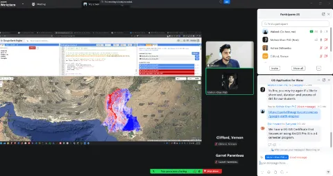
  • Delivered workshops and technical talks on cloud-based geospatial analysis, including tutorials on flood mapping, land surface temperature retrieval, and land cover classification using Earth Engine.
  • Mentored researchers and developers on adopting Google Earth Engine for environmental monitoring and disaster risk assessment through open-source projects and educational content.
Current Position
KAUST logo

Visiting Scholar

KAUST
2024 - 2025 Saudi Arabia
  • Developed a self-supervised deep learning pipeline for high-resolution flood mapping, trained on the Shaheen III supercomputer — one of the top 10 most powerful systems globally.
  • Investigated model-data fusion techniques, explainability, and uncertainty quantification to improve flood model transferability across diverse hydro-climatic regions.
  • Collaborated with the Urban Analytics Lab on research integrating remote sensing, computational geography, and environmental risk assessment.
Fiverr logo

Freelance GIS Consultant

Fiverr
2019 - 2025 Remote
  • Completed over 40 geospatial consulting projects with a consistent 5/5 client rating, covering remote sensing analysis, Earth Engine development, and spatial data processing.
  • Delivered end-to-end solutions including satellite image classification, flood risk mapping, land cover change detection, and custom GEE application development for international clients.
  • Translated complex geospatial analysis requirements into clear, reproducible workflows tailored to each client's domain and data constraints.
03.

Publications

View all

18 peer-reviewed journal articles, including two Web of Science Hot Papers, in venues such as Scientific Reports, the International Journal of Disaster Risk Reduction, the International Journal of Applied Earth Observation and Geoinformation, and the Journal of Flood Risk Management.

Cover unavailable
Featured
Journal Article 2026

A Cloud-Based Geo-AI Framework for Automated High-Resolution Flood Mapping with Explainable Machine Learning

Z. Cong, Mirza Waleed, S. Ullah, F. Tahir, S. G. Al-Ghamdi

Scientific Reports

Journal cover for International Journal of Applied Earth Observation and Geoinformation
Featured
Journal Article 2026

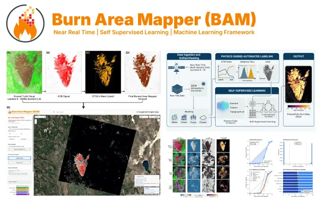
BAM: A Physics-Informed Self-Supervised Framework for Near-Real-Time Wildfire Burned Area Mapping from Multi-Source Earth Observation

Mirza Waleed, Muhammad Bilal

International Journal of Applied Earth Observation and Geoinformation

Journal cover for International Journal of Disaster Risk Reduction
Featured
Journal Article 2025

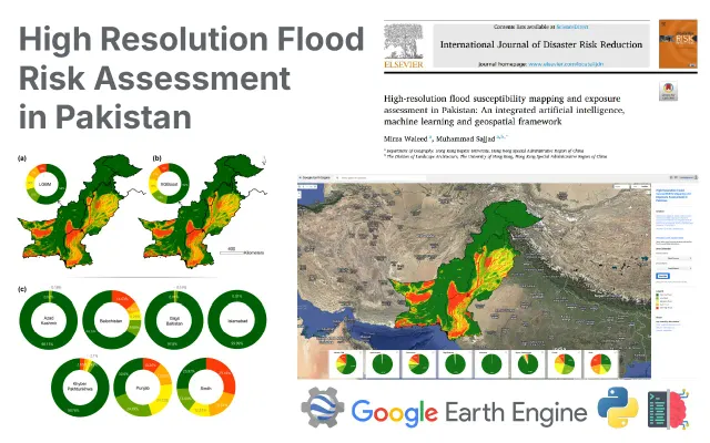
High-resolution flood susceptibility mapping and exposure assessment in Pakistan: An integrated artificial intelligence, machine learning and geospatial framework

Mirza Waleed, Muhammad Sajjad

International Journal of Disaster Risk Reduction

04.

Selected Projects

Selected GeoAI systems and open-source tools for flood risk, land-cover intelligence, and urban climate analysis — including GFSM v1, a global flood susceptibility dataset, and BAM, a near-real-time wildfire mapping framework.

05.

Posts

View all
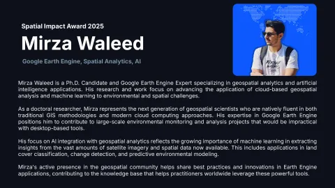
Mirza Waleed receiving the 2025 Spatial Impact Award for excellence in GeoAI
awards
Dec 1, 2025 2 min

Spatial Impact Award 2025

By Atlas.co, the Spatial Impact Award recognizes outstanding projects that leverage geospatial technology to address real-world challenges. In 2025, the award highlights innovative applications in environmental monitoring, disaster management, and sustainable development.

GEE Python Remote Sensing
Top GIS Voices 2024 recognition badge for Mirza Waleed on LinkedIn
awards
Dec 1, 2024 2 min

Top GIS Voices 2024

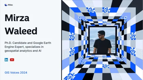
Selected by Atlas.co as one of the 50 most influential voices in the GIS community. This award recognizes individuals who are actively sharing knowledge, fostering innovation, and driving the geospatial industry forward through community engagement and technical expertise.

GEE Python GeoAI
07. Let's Collaborate

Contact

I am open to research collaborations, consulting, and speaking on GeoAI, flood risk and disaster intelligence, and cloud-native Earth observation — from academic partnerships to applied geospatial projects.