Global Flood Susceptibility Map (GFSM)
A globally harmonized flood susceptibility dataset at 30-meter resolution, produced using an XGBoost framework trained on multi-source geospatial data. Covers all major landmasses for localized flood exposure assessment.
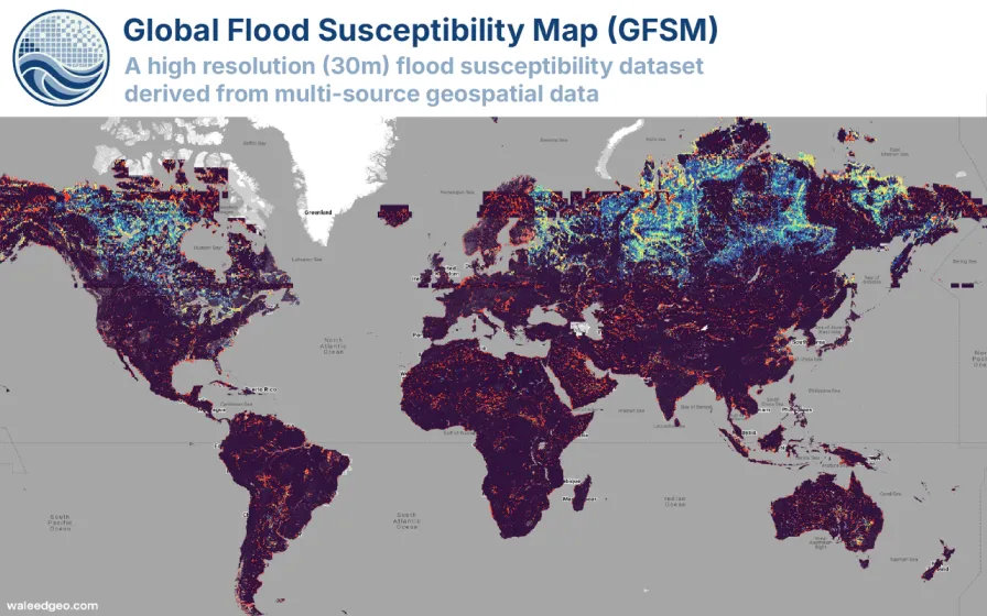
Objective. Existing global flood datasets either lack spatial resolution or rely on inconsistent regional methodologies, limiting their utility for localized risk planning.
Approach. Developed an XGBoost-based machine learning framework integrating 12 flood-conditioning factors from multi-source geospatial data (topographic, hydrological, land cover, and climatic variables) within Google Earth Engine. The model was trained and validated using historical flood inventory data and produced a globally harmonized susceptibility map at 30-meter resolution.
Impact. GFSM v1 is the first open-access, globally consistent flood susceptibility dataset at this resolution. The accompanying research was designated a Web of Science Top 0.1% Highly Cited (Hot) Paper. The dataset and interactive Earth Engine application are publicly available for disaster risk reduction planning.
Related Projects
Interested in collaborating or have questions about this project?
Get in Touch